Village or Rural economy plays an important part in the overall development of the country. A agrarian economy is how we describe our economy, meaning a large strata of society depends for agriculture for survival.
It is very important to learn and villages and formulate policies in order to ensure that maximum benefits and financial aid reaches them.
Now recently a new scheme has been launched by the Central Government under the leadership of Prime Minister Narendra Modi with the aim to increase the reach towards our villages. There are lot of societal agents involved when we talk about things like financial aid and how it must be distributed within the villagers.
What is “SVAMITVA” welfare scheme ?
Swamitva welfare Scheme is a Central Government scheme which provids ‘record of rights’ to village household owners possessing houses in inhabited rural areas and property cards to the property owners.
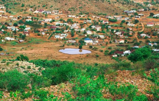
The plan is to survey all rural properties using drones and prepare GIS based maps for each village.
The welfare scheme known as SVAMITVA or Survey of villages and Mapping by using improvised technology.
The aim of the scheme is to provide the villagers with these specialized cards which will make the identification very easy.
The government is aiming at the target to provide every villager will this card and to make sure that the reach of the card is available to every village households from Kashmir to Kanyakumari.
This scheme will provide them with records which will help them identify their lands and in turn reduce disputes
The cards will be distributed in phases and the first phase has already started with the aim to cover atleast 1 Lakh villages in 8 different states of India. This is just a primary objective with the idea that all the villages are to be covered by 2023-24 and this means covering entire 6.62 registered villages of the country.
The panchayats or the local government will have a huge role in making the scheme successful. There are several steps that will be undertaken to complete the first phase of scheme and this starts with a memorandum of understanding signed between the Survey of India or what we call the SOI and the state governments across India.
The agency will be preparing a database using technology specially developed for topographical mapping and this includes satellite images, UAV’s and drones. On the successful signing of these MoU’s a specific CORS will be established.
Now CORS is basically a virtual station that is developed and is a common point for all other various stations. It basically adopts an method for more accurate Geo-referencing, ground truthing and distribution of lands in a more mathematical way.[1]
After this awareness among masses becomes an important step when they will telling people how and when the distribution will take place. The authorities will have to make sure that the entire populated area that is where people are living in the village will be distinguished with limestone.
Now the use of technology comes into picture, as now the drone will be used and hovered around the suggested boundaries and based on the images it provides a Gram Manchitra will be drawn. After this the team comprising of people who have knowledge of drone working and mapping will try and rectify any errors that might be there.
At this point if any person has some objection with respect to mapping or any other conflict. After all this inquiry is completed and systematic data is available, the agency then proceeds for the development of the said title deeds or Property Cards. The owners of card can avail e-copies as well as hard copy as per their convenience.
Now there comes hardship and that is what about future holders of the properties meaning how will the databases be maintained and who will be responsible for the maintenance. For this problem it has already been said that when the MOU is signed, the State government will automatically be subjected to this responsibility that they have to update this database on a regular basis. The cost for doing this will be borne out of their own funds.
With regards to the ownership of data, both Centre and State will play an important role will keeping the data.
The state revenue department will the actual owner because it is with them that the power of Right of Records rests and it is something under their purview.
They will have the responsibility to keep the databases updated and to make sure that the maps are also updated with view to any changes that might occur in future.
If any substantial update has been done or even if any slight update is done, all this will be shared between various village level officers like the tehsildar and patwari and this shall include any changes that have been made in past 1 year.
Now let us see what are the advantages that a person/ owner will have once he procures such a card.
- Financial Aspect- A lot of rural households need loans and other financial help while they think of getting materials for next harvest, and it is at this time that they are most vulnerable to all these shrewd moneylenders who charge them high interest rates so that they are never able to repay it and the loan keeps on mounting. Now if they have proper titles to their property, then they can go to banks and receive loans at a much lower rate and without harsh conditions.
- Tax benefits- Now with specified card and proper documents, recognition of properties will be easy, which in turn increases the ease to determine how much of tax may be levied on the property and this tax will be collected for the benefit of the gram panchayat.
- More liquidity in the market- Now dealing with land parcels will be easy plus there will be exponential growth in credit that will be available to land owners.
- Land Dispute- If proper maps and data is available with the Panchayats that a lot of disputes like private illegal encroachments, various construction permits that are required for works like MNAREGA and taxation will be easy to resolve.
- Planning for villages- With advanced form of maps the panchayat who are formed for 5 years and who are responsible for development of these areas for the said timeline can work in a better way.
- Removal of Middlemen- With the implementation of this scheme, middleman and their role will be reduced. They are the biggest hazard when we think of development and they increase corrupt activities in the panchayat.
Prime Minister while launching this scheme stressed on the fact that in all these years of independence the Congress government failed to account the needs of farmers. At this point in COVID times, we need to develop systems which will help our farmers counter the effect of this pandemic.[2]
He stressed on the fact that recently a lot of negative news has spread with regard to reform in farming sector, so the opposition must understand that they act judicially and wisely because they have an important role to play so as to secure democracy.
This scheme will be helpful for farmers in the near future and make them ‘Atamnirbhar’.
Farmers are the backbone of country and their development is very important, this schemes gives a lot of farmers who hold an area of land without proper papers to get so and subsequently make benefits out of this.
Tarun Ghai,
5th Year, National Law University, Odisha
- Harikishan Sharma, ‘Explained: What is SVAMITVA- the property card for rural households’ (19th October,2020) accessed on 19th October,2020 at https://indianexpress.com/article/explained/explained-what-is-svamitva-property-card-rural-households-6789007/ ↑
- ‘Property cards Launched ; will end disputes, says PM Modi’ (12th October, 2020) accessed on 19th October, 2020 at https://indianexpress.com/article/india/property-cards-given-to-40000-people-in-346-eastern-up-villages-6721293/ ↑